When Coupled Volcanoes Talk, These Researchers Listen
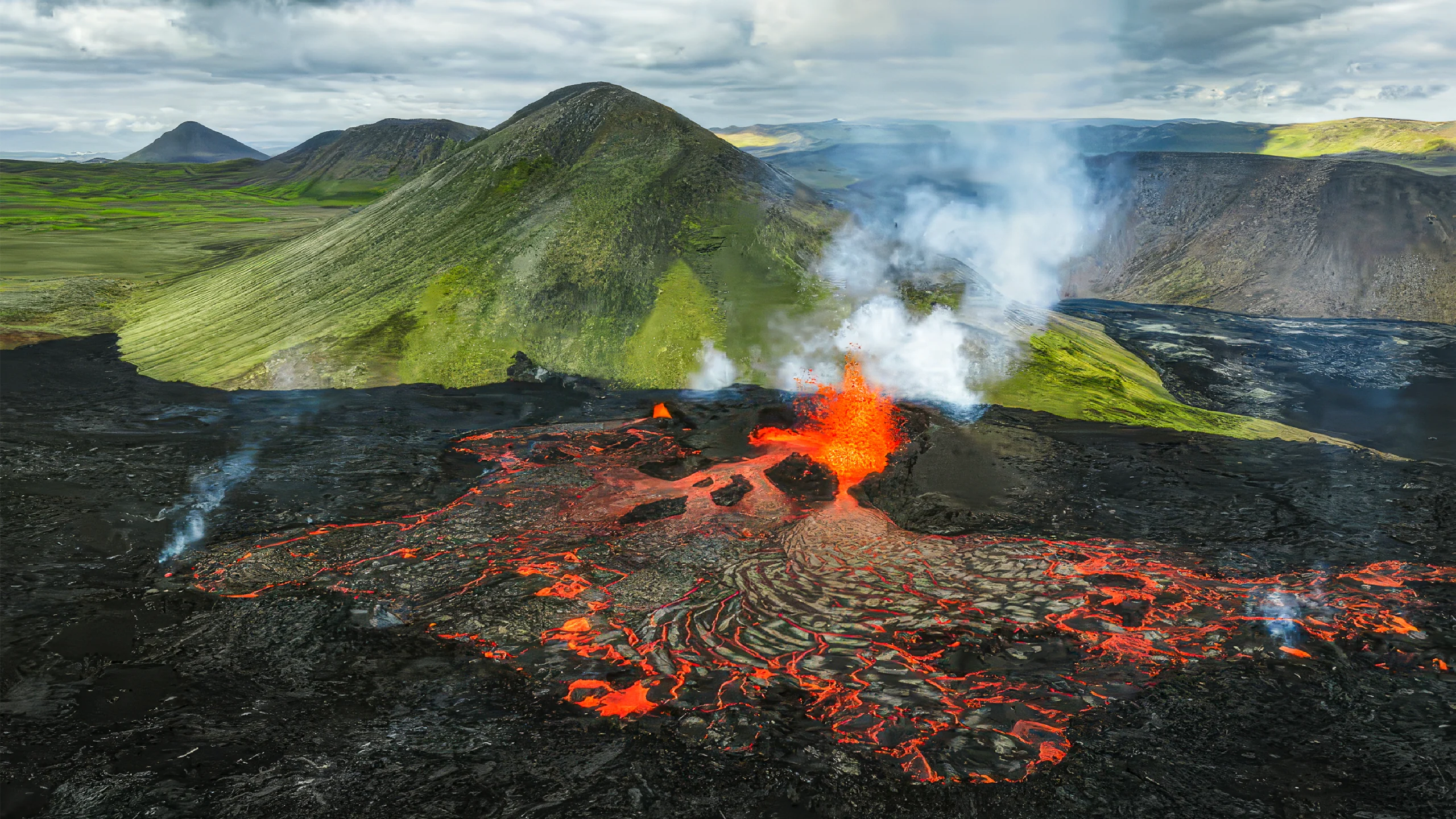
Iceland’s Fagradalsfjall fissure system erupted multiple times between 2021 and 2023, after which the Svartsengi fissure system seemed to take its place.
Guide to Iceland
Introduction
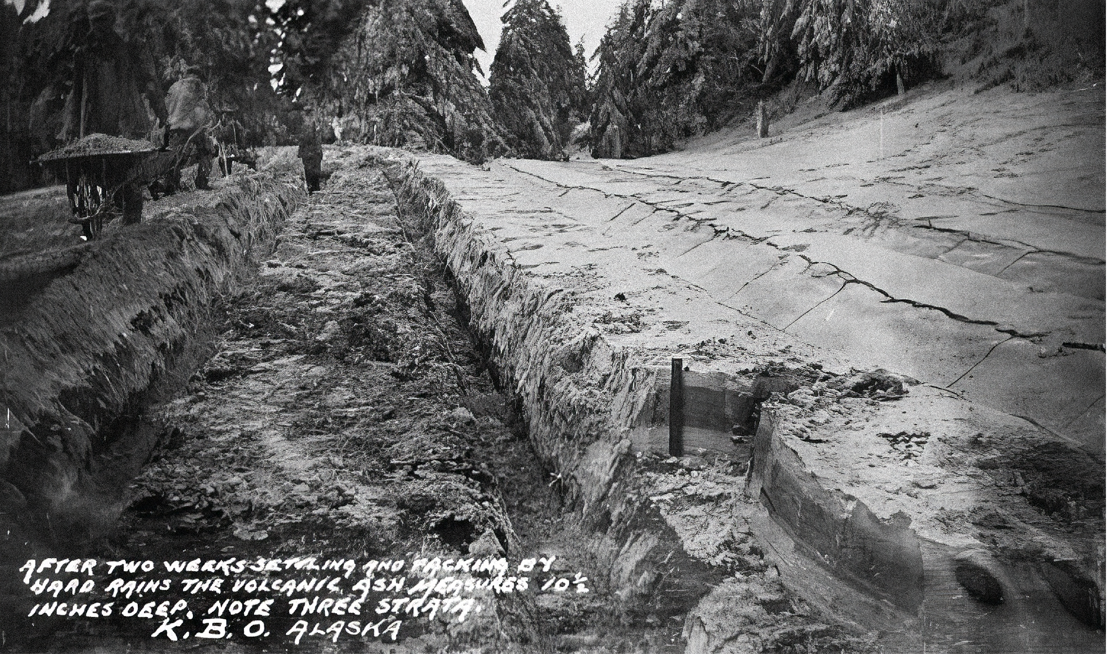
In the summer of 1912, word reached Robert Fiske Griggs that the apocalypse had arrived on Kodiak, an inhabited island off the coast of Alaska. The following year, Griggs, a botanist at the University of Ohio, led the first of several expeditions to the island, where he and a team glimpsed a disquieting sight: Kodiak was shrouded in a full foot of ash. And it wasn’t just the island. On the mainland on a formerly multi-peaked volcano called Mount Katmai, the soot-covered landscape was still venting noxious gas.
The environs of Mount Katmai had been home to a lush river valley. Griggs later wrote that on his surveying missions, he found that it “was full of hundreds, no, thousands — literally, tens of thousands — of smokes curling up. … Some were sending up columns of steam which rose a thousand feet before dissolving.” The site, which bubbled and hissed for decades, is still called the Valley of Ten Thousand Smokes.
Griggs and his fellow expeditioners were walking through the aftermath of the 20th century’s most prolific act of volcanism — a 60-hour frenzy that smothered much of the Pacific Northwest in onyx snow. Aerosols released by the eruption lingered for so long in the atmosphere that average temperatures in the Northern Hemisphere dropped by 1 degree Celsius for over a year.
The eruption did more than cool the skies and scorch an entire network of valleys. It also collapsed two of the three peaks of Mount Katmai into a single pit 1 kilometer deep and 2.5 kilometers across. At the time, it seemed obvious what had happened: Katmai had unleashed most of its magma, and it had left a giant chasm in its wake.
But the truth isn’t always obvious. In the 1950s, detailed geologic mapping of Katmai and its surroundings by Garniss Curtis, a geologist at the University of California, Berkeley, revealed that the eruption had emerged not from the now-collapsed peaks of the volcano, but from an opening in Earth’s crust 10 kilometers to the west that had never been seen before.
After extensive fieldwork, scientists reached a conclusion: Two-thirds of Katmai had disappeared because this opening had stolen Katmai’s magma. The idea was controversial, because volcanoes were always thought to act independently, tapping their own supplies of molten, eruptible rock. But Katmai and the opening, dubbed Novarupta, offered the first real clue that volcanoes could be connected, or “coupled.”
During the eruption in 1912, the town of Kodiak was buried in a foot of ash.
University of Washington via Wikimedia Commons
In the past decade, thanks to an improving suite of sensors and techniques and a stronger scientific understanding, researchers have identified other coupled volcanoes from Hawai‘i to Greece, and from Japan to Iceland. Each coupling is unique, said Diana Roman, a volcanologist at Carnegie Science in Washington, D.C., but fundamentally, coupled volcanoes “seem to talk to each other.” With sustained study, scientists are learning to listen in on what they’re saying.
Side Steps
Think of magma as being like a particularly infernal soup: a hot mixture of solid crystals and molten, gas-filled rock. Like soup, it comes in different flavors. Sometimes it’s suffused with a compound named silica, which makes it thick and gloopy like oil. Sometimes, it’s light on the silica, which makes it runny like hot honey. When magma breaches the surface of the Earth, it’s usually called lava.
Whatever its ingredients, magma is naturally buoyant. In general, “magma is supposed to go upward,” said Falk Amelung, a geophysicist at the University of Miami. But Novarupta’s act of magma theft provided the first hint that molten rock might be nimbler than scientists realized. “We’ve been so busy thinking about how magma gets from depth to the surface that maybe we’ve reduced the problem to one dimension,” said David Pyle, a volcanologist at the University of Oxford.
In the 1950s, researchers discovered that Katmai wasn’t responsible for the cataclysm of 1912 when they mapped the eruption’s ashfall. Instead of forming a concentric pattern around Katmai, the ash encircled Novarupta.


Mark Belan/Quanta Magazine
Further proof emerged in studies of volcanic rocks found at Katmai called andesites and dacites, which had the same chemical composition as those blasted out of Novarupta. “It’s a perfect match,” said John Eichelberger, a volcanologist and natural-hazards researcher at the University of Alaska, Fairbanks. In addition, the volume of rock removed during the Katmai collapse was almost exactly equal to the volume of rock propelled from Novarupta.
Geologists now believe that magma below Katmai moved sideways for several kilometers before emerging at Novarupta. “There’s no question there’s a direct connection between Novarupta and Katmai,” Eichelberger said.
But no one is sure why the magma moved this way. Eichelberger said he wonders if the situation was a bit like the activity in an artesian well, wherein pressurized fluids underground naturally flow out of a new opening. In this case, the opening at Novarupta was probably created by a rogue stream of rising magma that smashed its way through the crust. This opened a low-pressure channel, and Katmai’s own magma moved sideways toward it.
The eruption wasn’t monitored with modern instrumentation, so scientists can only offer their best guesses as to what happened. To build up their body of evidence that magma could move between coupled volcanoes, they would need to capture the process with high-tech sensors in real time.
In 2014, they did just that.

The peaks of Mount Katmai partially collapsed in 1912, leaving a crater behind.
Steven Prorak/Alamy
Cold Connection
Iceland is a floating fortress of volcanoes. That’s partly because the country sits atop the boundary of two diverging tectonic plates; it’s constantly being pulled in two.
In 2014, a spike in earthquakes beneath the cauldron-shaped Bárðarbunga volcano seemed to suggest that an eruption was imminent. But the quakes migrated away from Bárðarbunga, and lava eventually gushed out of several fissures in the realm of another volcano, Askja, at a site named Holuhraun, 45 kilometers away.
This was the first time scientists had seen magma appearing to travel so far from one volcano to the next. That’s “a really long way for magma to travel laterally,” said Kristín Jónsdóttir, the head of the department of volcanoes, earthquakes, and deformation at the Icelandic Met Office.
By 2020, another part of the island nation, the Reykjanes Peninsula, had begun to quake. Scientists dotted the area with sensors that allowed them to track the subterranean migration of magma with remarkable precision. They used seismometers, which can record the sound of magma as it smashes through the crust, along with instruments that measure the changing shape of the ground.
Soon after they finished setting up, the peninsula’s Fagradalsfjall fissure system sprang to life for the first time in about eight centuries. It erupted repeatedly between 2021 and 2023. Then, in late 2023, a different fissure system, called Svartsengi, took over. It erupted every few months while Fagradalsfjall fell silent.
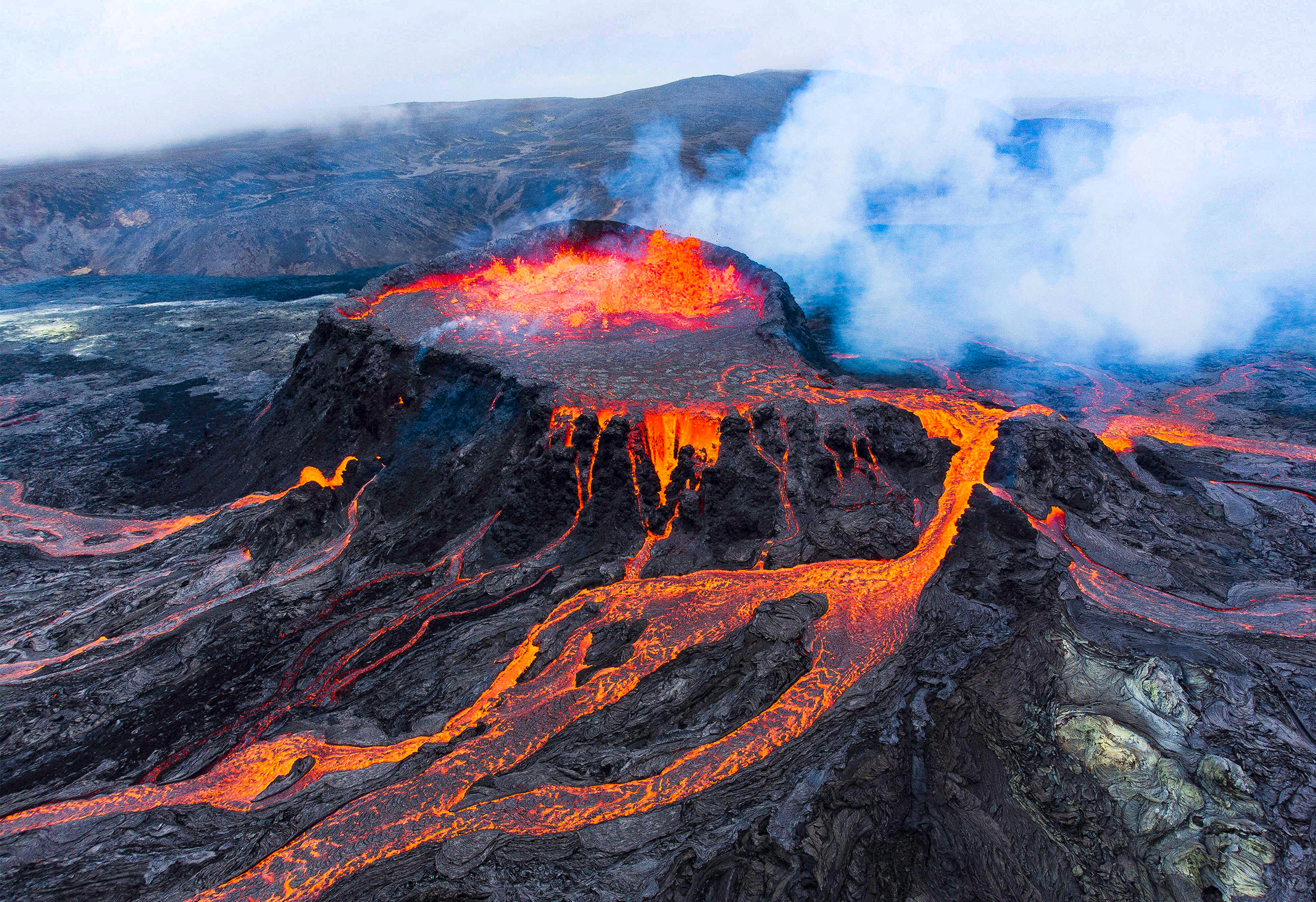
Smoke and lava erupt from Iceland’s Fagradalsfjall volcano in 2021.
Rowan Castle/Alamy
“They’re never doing something at the same time,” Jónsdóttir said. “For them to take turns like that … it’s very suspicious.” It seemed that, just like Bárðarbunga and Askja, Fagradalsfjall and Svartsengi were coupled.
Half a world away, another scientist was working on the tools to turn these magmatic connections into a map.
Hot on the Trail
For decades, scientists have used earthquakes to track magma, but the work was often slow and imprecise. Until recently, scientists could only manually read through graphs of seismic recordings to pick out tremors, then use the data to trace the movements of magma that caused them. Many of the more subtle quakes, buried in background noise, were invisible to human eyes.
In the 2010s, Zach Ross, a geophysicist at the California Institute of Technology, wanted to improve on the quake-finding process. He trained a machine learning program on various seismic symphonies recorded across California over a decade. Ultimately, the program identified 10 times more tremors than any human-led seismic survey had been able to find. As a result, previously invisible fault networks throughout California lit up like fireworks.
Next, Ross tried a new, more advanced version of his quake-finding algorithms on data from Hawai‘i. Hawai‘i, like Iceland, is full of volcanoes. And while many are extinct or dormant, two of them, Kīlauea and Mauna Loa, are still capable of destructive and deadly eruptions.
Volcanologists largely suspected that Kīlauea and Mauna Loa acted independently. The chemistry of their erupted lavas couldn’t have looked more different, and there wasn’t any compelling evidence to suggest that an eruption at one could affect the other.
In 2019, there was a maelstrom of seismic activity near Kīlauea, deep below the town of Pāhala. Ross fed recordings of the shaking to his algorithms to generate a 3D map. In the process, he uncovered a giant system of passageways.
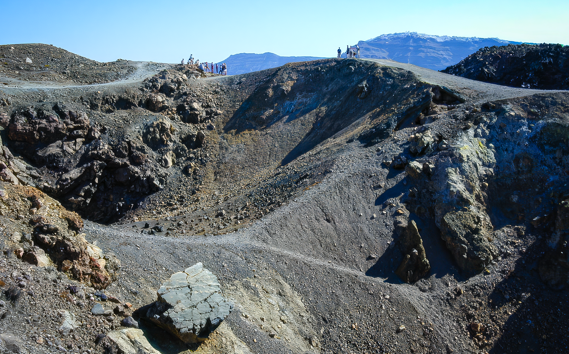
Hikers visit volcanic craters in Santorini in 2001.
Rolfsteinar via Wikimedia Commons
At the heart of this magmatic circulatory system was a series of horizontal reservoirs called the Pāhala sill complex. From those reservoirs branched two arteries, one leading to Kīlauea, the other reaching toward Mauna Loa. “I remember very clearly how we all reacted when we first saw that in my office,” Ross said. “It was pretty shocking.”
The idea that the two shared a deeper magma source but erupted two chemically distinct types of lava made people “really uncomfortable,” Roman said. But the seismic evidence was impossible to ignore; they seem to be coupled.
Their connection seems different — more mercurial, changeable, compared to those of other coupled volcanoes. Sometimes, as with Iceland’s volcanoes, the ones in Hawai‘i take turns erupting. This could be because one taps magma from their shared source so aggressively that the other volcano doesn’t have much left to extract. But on other occasions, both erupt at the same time. This could be because the magmatic heart that connects them fills up with so much magma that both volcanoes “get juiced,” Roman said.
Joining the Conversation
Santorini is a C-shaped Greek island with a violent volcanic past. The most catastrophic outburst of its volcano, in roughly 1600 BCE, contributed to the end of the seafaring Minoan civilization. Today, two small new volcanoes are growing out of its bay, and another one called Kolumbo — capable of producing fearsome tsunamis and clouds of suffocating gases — lurks underwater just offshore.
Unsurprisingly, the region is comprehensively monitored by scientists. In 2024, a new German-Greek venture called Multi-Marex began to install layers of sensors on not just the land but also the seafloor around Santorini. The effort paid off almost immediately, said Jonas Preine, a volcanologist at the Woods Hole Oceanographic Institution; by chance, at the end of January 2025, the region began to shudder.
Large earthquakes rocked Santorini, and many of its residents fled, fearing an eruption. “The residents were so worried,” Preine said. But after several weeks, the quakes dropped off. At the same time, both Santorini and Kolumbo shrank.
What happened? The tectonic architecture of the Aegean Sea is messy, rife with crisscrossing faults and myriad volcanoes that make unraveling what happens at depth extremely difficult. But scientists analyzing Multi-Marex data with the assistance of machine learning quickly produced an explanation: A stream of magma had risen from a great depth to just 3 kilometers or so below the surface. The magma didn’t have enough momentum to punch through to the surface, but it did seem to borrow some of its molten rock from elsewhere.
Another magma reservoir in the crust, one thought to feed Kolumbo, contracted as its reserves drained away. It certainly seemed like another case of volcanic coupling — and the team hopes their improved understanding leads to more accurate forecasting of Santorini and Kolumbo’s future volcanic activity.
In Greece and Hawai‘i, and in other locations like Central Africa and Japan, researchers are looking for the next sets of coupled volcanoes, which they know might exhibit a variety of connected behaviors, including taking turns or erupting simultaneously. They now know that coupled volcanoes won’t necessarily produce the same type of lava or the same type of eruption. And they know not to underestimate how far magma might travel on its journey to the surface, and how deep the connection between coupled volcanoes might be.