When Quiet Undersea Volcanoes Turn Disruptive
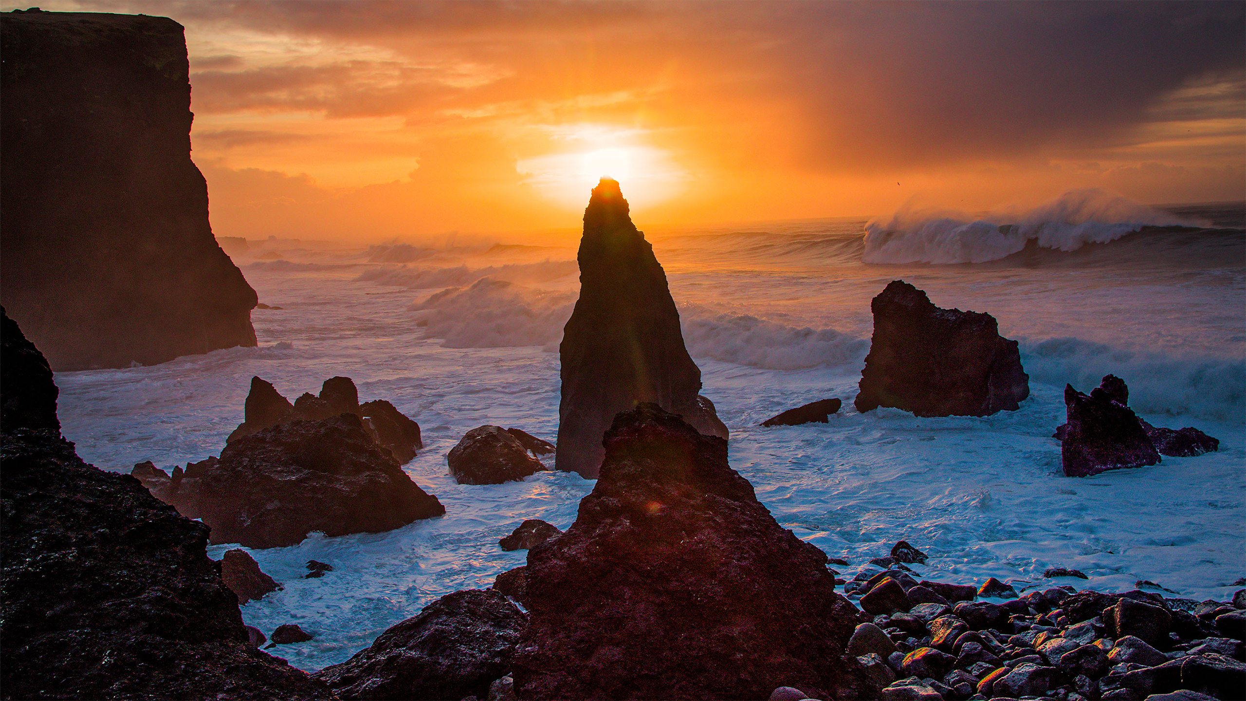
Rock formations emerge from the waves along the shore of Iceland.
Jonas Preine
Introduction
Jonas Preine, a recently minted Ph.D. from the University of Hamburg, squinted at a computer screen in the lab of a ship as it bobbed in the North Atlantic near Iceland. The image before him just didn’t make sense.
It was June 2024, and Preine was among a crew of scientists who had set off from Reykjavik under slate-colored skies, trading their regular lives — family, friends, and the typical office environment — for cramped quarters and nausea on board the Meteor, a research vessel chartered for Expedition M201. They’d been lucky so far, enjoying relatively calm seas as they motored toward their destination, an unexplored deep-water basin dotted with volcanic shapes. The researchers carried reams of equipment: geophysical tools to collect seismic profiles of the Earth’s interior, cameras to image the ocean floor, and coring and dredging equipment to sample rocks and verify what might appear in grainy, partially processed computer images.
That first evening, about 100 kilometers from port, the team paused to test their geophysical tools in shallow waters. The seismic imagery they collected of the seafloor’s layered interior would lead them to an unexpected discovery, one that would complicate what we know about the usually sluggish volcanic fissures that lace the bottom of the ocean. Their findings could also be connected to mysterious islands from the recesses of history that witnesses said appeared suddenly, only to disappear later beneath the waves.
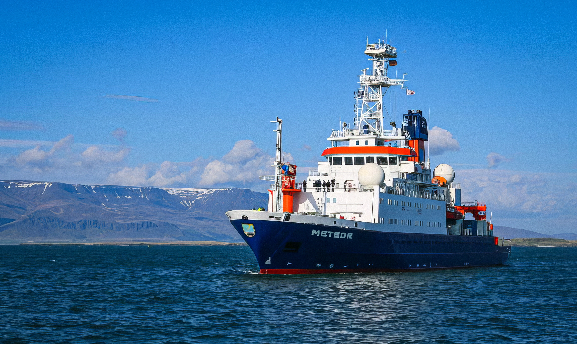
The Meteor transported the scientists on Expedition M201 to their research site off the coast of Iceland.
Jonas Preine
In the lab, Preine snapped some screenshots and shared them with the team. Six weeks later, on returning from the expedition, he needed little effort to convince the project’s lead scientist to stop in shallow waters to investigate what they’d found.
A Conveyor Belt of Lava
Iceland is a geological rarity. Here, on the world’s largest volcanic island, you can hike through gorges dividing the North American and Eurasian tectonic plates.
That’s because Iceland sits on a mid-ocean ridge, a vast seam where Earth’s crust tears apart and oceans grow in the expanding space between. The Mid-Atlantic Ridge began forming about 200 million years ago, as the supercontinent Pangaea broke apart at the end of the Triassic Period. Iceland emerged much later when a plume of unusually hot mantle rock arched the ridge up above the gathering waves.
Across the globe, mid-ocean ridges have a nondramatic style — nothing like Washington State’s explosive Mount St. Helens or southern Italy’s Mount Vesuvius, the destroyer of Pompeii and Herculaneum. So the team aboard the Meteor wasn’t expecting anything unusual when they passed over a submerged segment of the Mid-Atlantic Ridge called the Reykjanes Ridge. They just wanted to confirm that their equipment was in working order.
The crew switched the equipment on, pinging back X-ray-like images that revealed layers of the seafloor’s stone interior. “We decided to do two test profiles over the Reykjanes Ridge because it was logistically easy and potentially interesting,” said Preine, now a marine geophysicist at the National Oceanography Center in England.
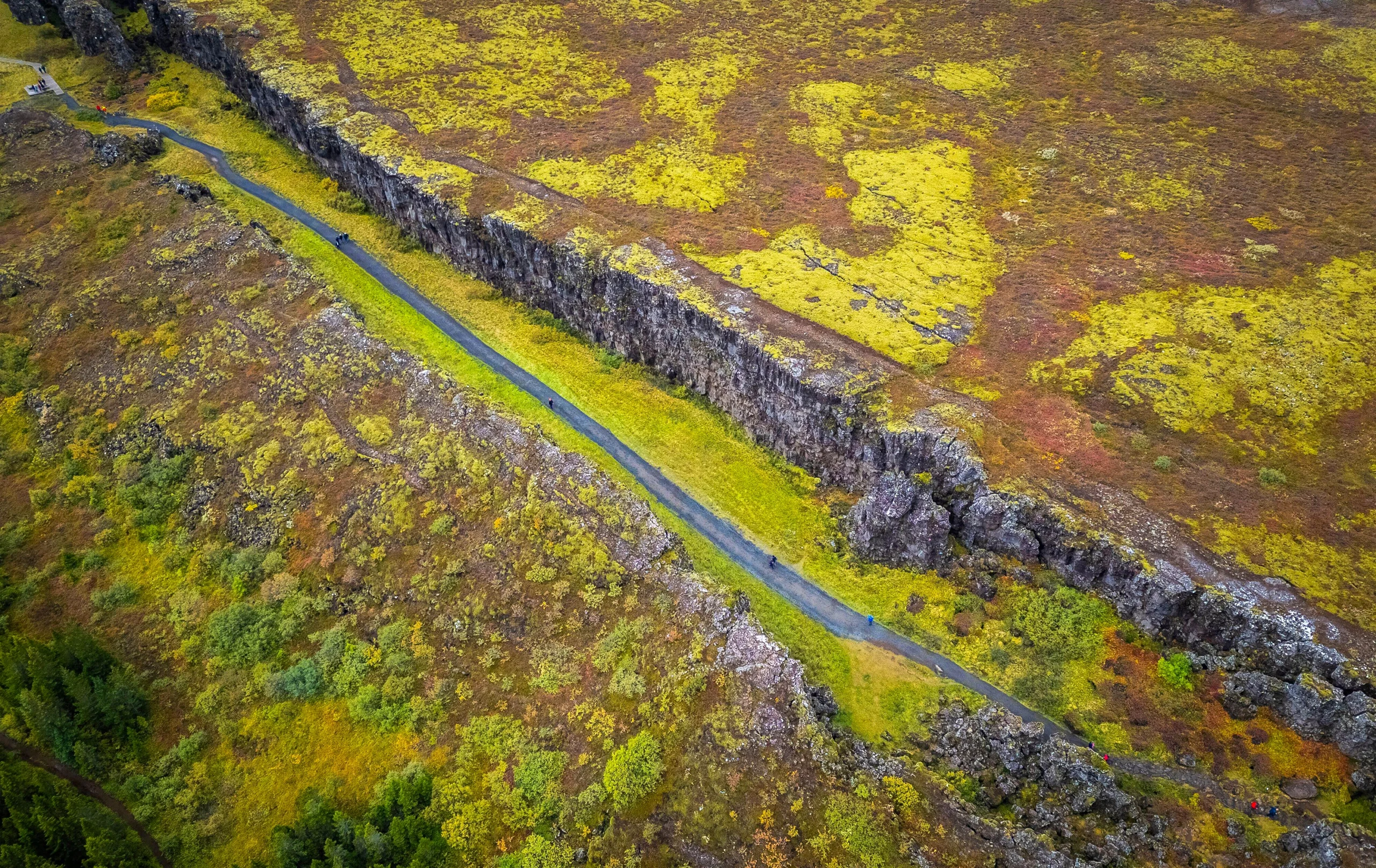
In Iceland’s Thingvellir National Park, hikers can travel along a path between the North American and Eurasian tectonic plates.
mauritius images GmbH/Alamy
Seismic images of mid-ocean ridges typically show rough and jagged terrain, formed when lava oozes up into the cold ocean along faults or fissures and hardens suddenly into stone. But that’s not what Preine saw. Along the ridge were smooth mounds with steep sides and flat tops, their flanks draped in scattered deposits that looked like debris from an eruption above the sea surface. The formations reminded him of the topic of his doctoral dissertation, a submerged system of notoriously explosive volcanoes near Santorini, Greece.
Why did there seem to be explosive volcanoes along the usually quiet mid-ocean ridge? And why were their tops beveled flat?
A Fleeting Apparition
Oceans, vast and deep, remain largely unexplored. For generations, scientists could do little more to study the depths than dredge the seafloor, dragging buckets for whatever they could find. Only in recent decades have geophysical technology and deep-sea cameras provided glimpses of these mysterious worlds.
There are more volcanic eruptions in the oceans than on land, said Isobel Yeo, a volcanologist at the National Oceanography Center who was not involved in Expedition M201. “We just don’t know nearly as much about them.”
Here’s what we do know: Across most of the globe, the crushing weight of the abyss suppresses explosive eruptions at mid-ocean ridges. Most of the Mid-Atlantic Ridge lies at least 2,500 meters below the sea, where extreme pressure keeps volcanic gases from expanding and limits eruptions to quiet outpourings of lava.
When the expedition returned, more profiles and imaging made it clear that the team had stumbled on the boundary where that restraint lifts: The Mid-Atlantic Ridge changed character at around a depth of 300 meters. That transition could explain an incident from Iceland’s recent history.
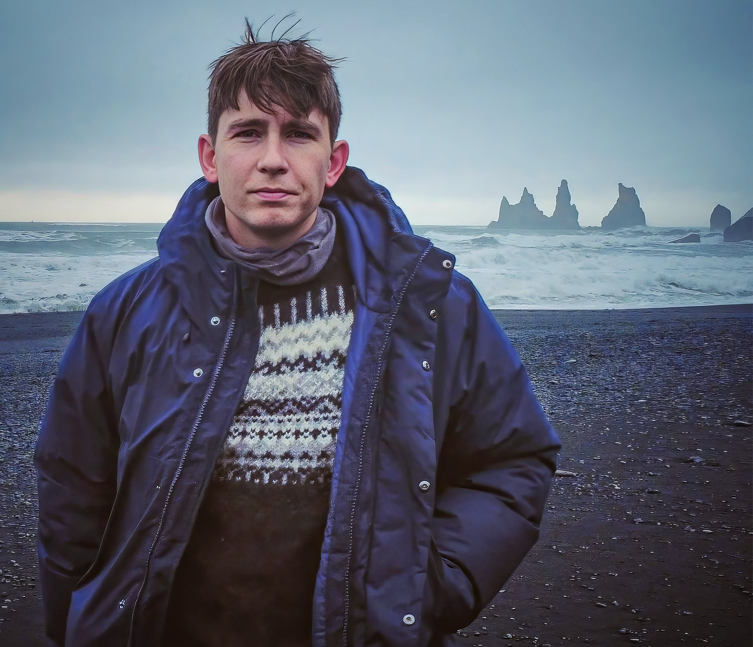
Jonas Preine, now a marine geophysicist at the National Oceanography Center in England, is studying the Mid-Atlantic Ridge.
Courtesy of Jonas Preine
Without warning on November 14, 1963, new land emerged from the cold black waters off the coast of Iceland. Over the course of three years, a volcanic island spewed and sputtered as it rose 171 meters above the sea. The government of Iceland named the island Surtsey, after the Icelandic mythic fire god Surtur.
Throughout history, so-called phantom islands — many of them volcanic — have occasionally sparked frantic, even quasi-comedic claims and naval tensions. “There were humorous reports of the Royal Navy stopping to put a flag on them when they breached sea level, only to see them disappear by wave erosion,” wrote Neil Mitchell, a geophysicist at the University of Manchester, via email.
While some of these phantom islands emerged from more volatile volcanic zones, others, including Surtsey, appeared mysteriously along the gently oozing mid-ocean ridge. In total, historical records document at least 14 eruptions on the northern Reykjanes Ridge in particular over the last 1,000 years.
Preine and his colleagues felt they had a unifying explanation for Surtsey and the strange subsea volcanoes they’d observed. They could pinpoint a specific depth at which the pressure eased just enough to allow seawater in contact with lava to flash to steam, powering an explosive eruption that could breach the sea’s surface.
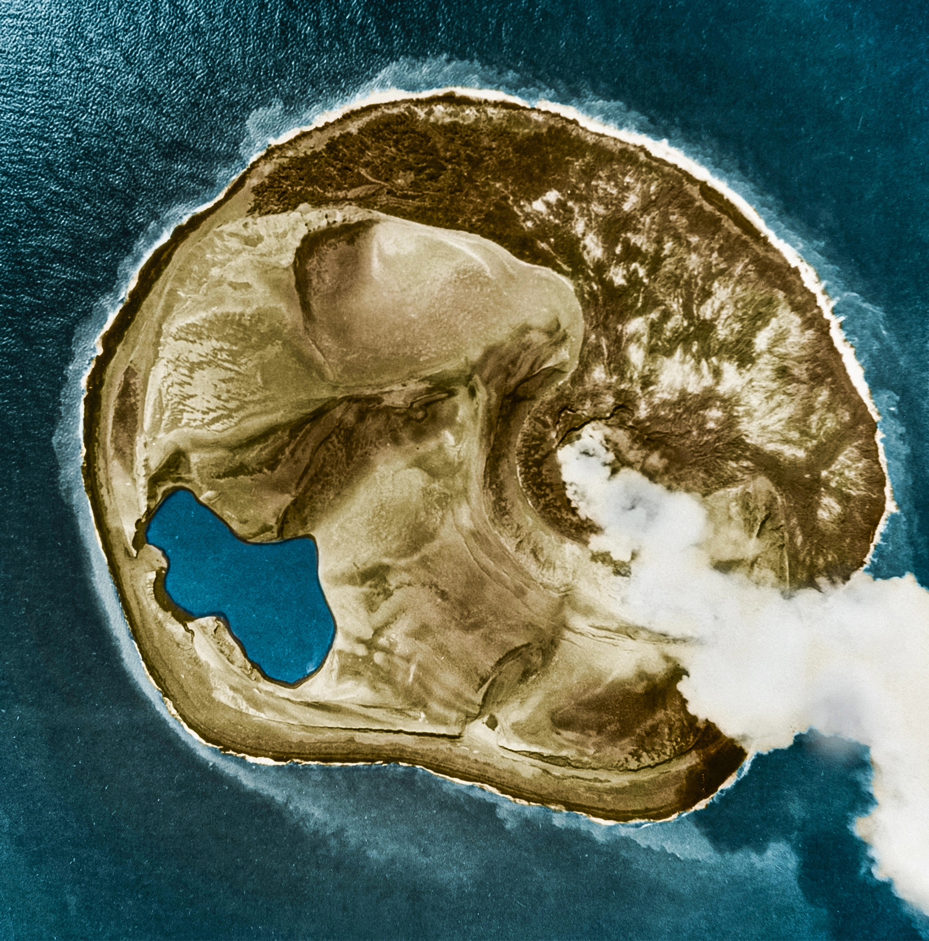
Surtsey, a volcanic island off the southern coast of Iceland, emerged from the sea in the 1960s.
Omikron/Science Source
The deposits that blanketed the volcanoes’ steep flanks were critical clues, Preine said. Water dampens how far debris gets thrown, as anyone who has ever tried throwing an object underwater can confirm. So the material from underwater eruptions settles close to its source. Once a volcano breaches the sea surface, though, it can scatter ash and rock debris much farther. This can go on for days, months, or even years. Then, once the magma chamber is exhausted, the sea takes over again.
In Iceland, the sea is a force. Preine said the region’s underwater flat-topped volcanoes are worn down to a uniform depth of around 40 meters below sea level — no coincidence, he argued, since North Atlantic storm-wave erosion only reaches down that far. “The key parameter here is depth,” said Ross Parnell-Turner, a geophysicist at Scripps Institution of Oceanography at the University of California, San Diego, who was not involved in the work of Expedition M201.
The influence of lower water pressure and the force of the Atlantic’s waves seemed to explain Expedition M201’s observations. But there was another factor to consider.
A Land of Ice
Páll Einarsson vividly recalls the day in 1963 when Surtsey began erupting. His father, a volcano-curious engineer, drove him to the airport, where he had convinced an airline pilot to take an impromptu flight over the new volcano. From the plane, father and son watched the plume of dark smoke emerge from the endless northern seas.
Einarsson went on to study volcanoes, among other things, and is now an emeritus geophysicist at the University of Iceland. When asked about Expedition M201’s findings, he said he was impressed by the team’s efforts but not fully convinced of their theory about how the flat-topped volcanoes formed. That’s because, for different reasons, similar volcanoes appear both in the deep ocean and on land.
Some 20,000 years ago, Iceland was covered with slow-moving glaciers. Today, glaciers remain across approximately 11% of the country, and the areas left behind are home to squat mountains called tuyas, or table mountains. Some scientists think the tuyas formed when rising magma collided with a thick ceiling of ice and melted it, triggering explosions. But like a paving stone above a cluster of mushrooms, the glaciers acted like a lid, preventing the volcanoes from growing too tall.
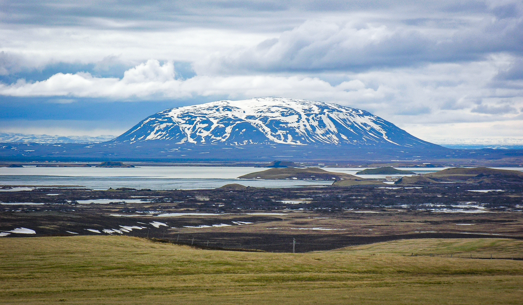
Tuyas are steep-sided mountains with flat tops found in just a few places in the world, including Iceland. They are sometimes called “table mountains.”
Hansueli Krapf/Wikimedia Commons
During the last ice age, the sea level was far lower than today, and Iceland’s glaciers extended across the exposed Reykjanes Ridge. That glacial advance appears to have reached roughly the area that now lies beneath about 300 meters of water, where Expedition M201 identified the flat-topped volcanoes. The research team initially wondered whether the submerged mounds could be drowned versions of tuyas.
They did find evidence against the glacier theory: The volcanic material appeared to have accumulated on top of abandoned glacial rubble, suggesting that the eruptions happened after the glaciers retreated. Most outside experts interviewed for this story say they’re convinced that these observations rule out the theory, but Einarsson would like to see more evidence.
Scientists know what they need to resolve this tension: rocks, or at least a good look at them from a submersible vehicle.
With explosive submarine eruptions, “it looks like someone dumped a truckful of volcanic sand over everything,” said Robert Sohn, a geophysicist at the Woods Hole Oceanographic Institution in Massachusetts who was not involved in the work. “It’s immediately obvious.” But Preine and company have only limited material from seafloor dredging in the area and not enough direct visuals to substantiate their theory.
It will take a while to gather new evidence, though, as deep-sea exploration plans are formulated years in advance. “You sail into the middle of nowhere based on a point that somebody put on a map, and you hope very much that they’ve put that point in the right place,” Yeo said. “You’re sort of stuck with the decisions past-you made.”
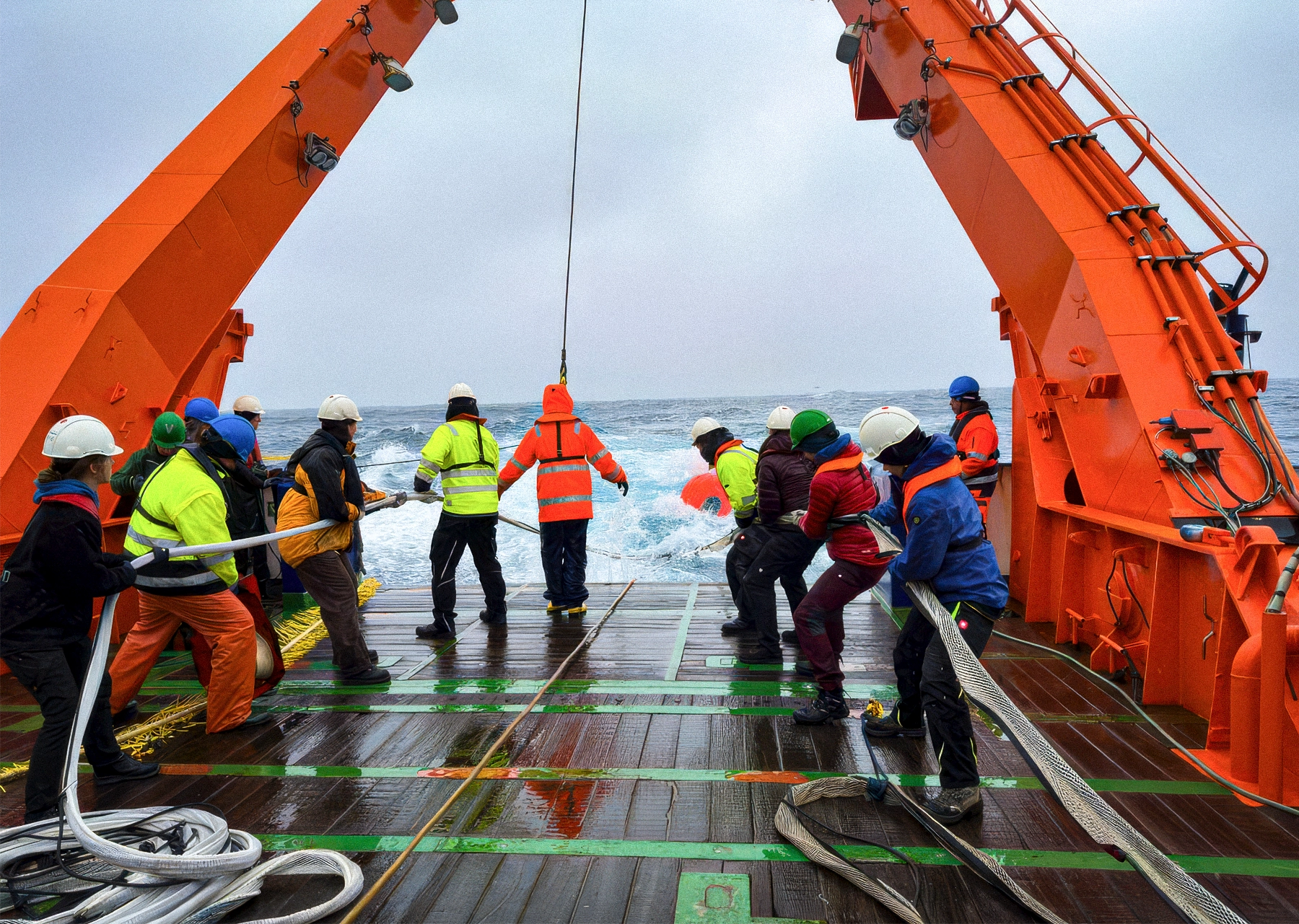
The science team for Expedition M201 deploys seismic equipment off the deck of the Meteor research vessel.
Jonas Preine
Preine is keeping an open mind. He’s not so quick to dismiss the influence of ice, though he thinks it may have played a different role. Like seawater, ice exerts pressure on the Earth’s crust, suppressing volcanic activity. When ice sheets retreat, as they did along the Reykjanes Ridge, that pressure is released, causing volcanic activity to spike. Preine said sampling rocks to determine the ages of the volcanoes would be “extremely interesting” in testing what remains a working hypothesis: that receding glaciers indirectly fueled a new volcanic era.
Eruptions Past and Future
As Surtsey so vividly demonstrated, the behavior of mid-ocean ridges can shift from calm to explosive under the right conditions. Scientists now suspect that this may have been more common in the past — and wonder when it could happen again.
Whatever researchers discover about the Mid-Atlantic Ridge, the pattern may extend far beyond Iceland. Shallow stretches of mid-ocean ridges, from the Azores to the Galápagos to the Red Sea, cross the same depth threshold. In those places, the slow conveyor belt of the deep may occasionally give way to something more volatile, building islands that briefly rise above the surface before waves grind them back again.
There’s a reason to give Iceland special attention, though. Since around 2020, a giant magma chamber has swelled under the Reykjanes Peninsula, the onshore limb of the Reykjanes Ridge, triggering earthquakes and sending lava oozing into the streets. In 2023, the fishing town of Grindavík’s about 3,700 residents evacuated, many perhaps for good.
Now scientists say that pressure is building again. “We are really in the middle of a very remarkable event right now,” Einarsson said.
Offshore, most of that activity remains hidden. But the same forces are at work, Preine said, and “the chances are not low” for another Surtsey to rise again. “A colleague sent me an email saying that there was actually an earthquake swarm on the Reykjanes Ridge this week,” Preine said in January. “Nothing big, but you never know.”
Correction: May 27, 2026
The original article said that Surtsey emerged from the Reykjanes Ridge. In fact, Surtsey is southeast of there. In addition, the article misstated the name of Páll Einarsson’s father.